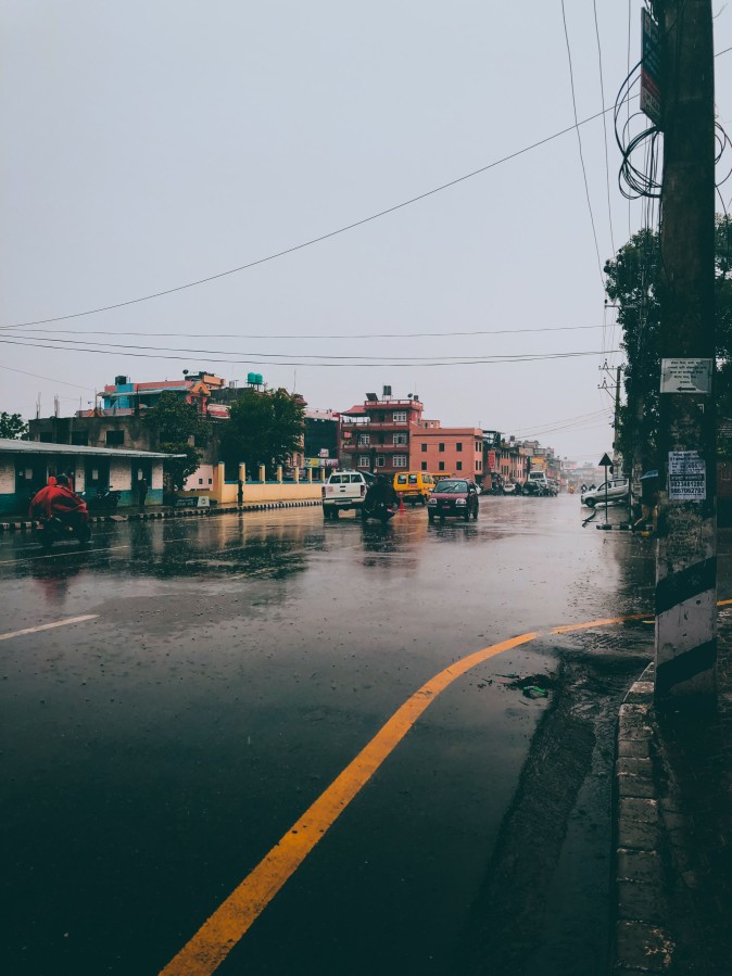
Thamel, Kathmandu, Nepal
Which Areas and Trekking Routes Are Affected by the 2026 Nepal Floods?
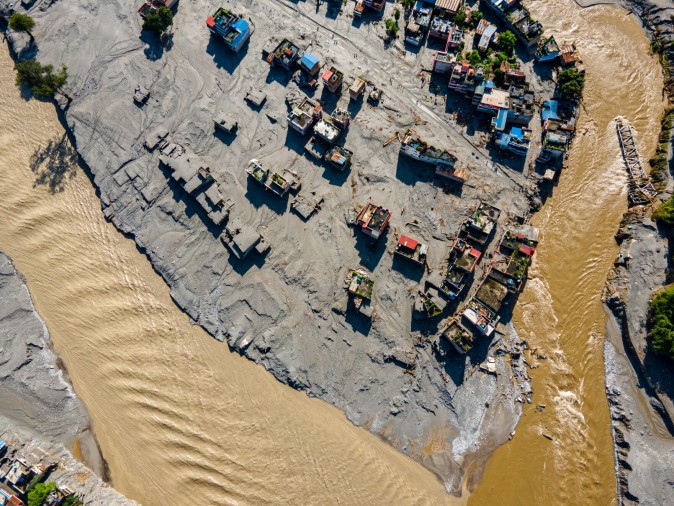
On the morning of 26 August 2026, a catastrophic flash flood surged down the Bhote Koshi River from the Nepal–Tibet border, devastating parts of Rasuwa district. The debris-laden waters destroyed or severely damaged riverside settlements, including areas around Timure and Syabrubesi, and continued downstream through the Trishuli corridor, affecting communities in Nuwakot, Dhading and beyond.
The disaster claimed many lives, left hundreds missing (figures remain provisional as search and rescue continues), and displaced numerous households. Critical infrastructure was heavily hit: multiple bridges were washed away, sections of key roads were destroyed or blocked, hydropower facilities were damaged, and local transportation and communication networks were disrupted.
This event has also affected trekking access in Nepal, particularly the road gateway to the Langtang region via Syabrubesi, while other major trekking areas remain geographically separate from the main impact zone.
Which Areas and Trekking Routes Are Affected by the 2026 Nepal Floods?
An ice-rock avalanche high on the Nepal-Tibet border blocked the Lhende Khola stream on the morning of August 26. When the resulting ice-and-debris dam failed, it released a sudden wall of water down the Bhote Koshi gorge. The flood ran south through Timure — the trading village that serves the border — past Syabrubesi, the trailhead town for the Langtang treks, and onward down the river system toward Trishuli Bazar, damaging homes, roads, and power projects along roughly 60 kilometers of valley. Districts as far downstream as Nuwakot and Dhading were put on alert as the flood pulse moved toward the plains.
🟠 Key point: The disaster hit the road corridor and the gateway towns. It did not automatically flood every trail in the region — that distinction matters, and we unpack it in detail below.
The main gateway town for Langtang treks suffered significant structural damage, with Ward No. 5 named by officials as having confirmed structural damage. The town sits at the confluence of two rivers — the Bhote Koshi (the one that flooded) and the Langtang Khola (not the flood source). That distinction turns out to be the single most important geographical fact in this entire disaster for trekkers.
Timure and the Rasuwagadhi Rural Municipality suffered major destruction; the helipad itself was swept away, complicating rescue operations. This zone lies north of Syabrubesi, on the road toward the Chinese border. It is not part of the Langtang trekking trail itself, but it is the route used for side trips to the border and for the overland Kailash Mansarovar pilgrimage route — now closed for the 2026 season.
This is the river that actually flooded, originating in Tibet and joining the Trishuli River system near Dhunche/Betrawati.
Once the flood pulse entered the Trishuli, impacts reached Trishuli Bazaar and Devighat in Nuwakot, with alerts extended to Dhading, Gorkha, and Chitwan, as far downstream as Mugling. This is a flood-warning zone — not a trekking-trail zone. No major trekking routes run through this lowland stretch.
Downstream flooding damaged riverside property and infrastructure. The government has ordered emergency medical treatment, search and rescue mobilization, and restoration of roads, power, and telecoms. Nuwakot is a transit district for the Kathmandu–Syabrubesi road but has no major independent trekking routes of its own.
China's Ministry of Natural Resources activated its emergency response after the Gyirong mudslide on the Tibetan side. This is the cross-border trade and Kailash-pilgrimage gateway — not a Nepali trekking trail — but its closure ends the overland route to Mount Kailash via Nepal for the 2026 season.
Why the region is affected :
Not because the trail itself was hit, but because Syabrubesi — its only road gateway — was.
Importance of Syabrubesi as a gateway:
Syabrubesi is the standard starting point for the Langtang Valley, Tamang Heritage, and Ganja La treks.
Condition of road access:
The Nepal Tourism Board has specifically advised postponing travel to flood-affected areas, including the Galchhi–Nuwakot–Rasuwa–Syabrubesi corridor, until road and safety conditions improve.
Has the trail itself been physically damaged?
This is the critical distinction. The Langtang trail climbs east from Syabrubesi up a different valley from the one that flooded. One operator on the ground put it simply: "Two rivers meet at Syabrubesi and only one of them flooded. The Langtang trail follows the other one." This has not yet been independently confirmed by a government damage assessment specific to the 2026 event.
Is the route currently accessible?
Not confirmed either way. The region has been indirectly impacted, and access to Syabrubesi is heavily disrupted — but there is not yet enough information to confirm the trail itself has been destroyed or made unsafe.
Is access the primary problem?
Yes — the evidence points to a road-access problem, not confirmed trail destruction.
Have authorities issued restrictions?
Public vehicles from Kathmandu toward the affected areas have been halted, and Langtang road access is not currently normal.
What trekkers should do before planning the trek:
⚠️ Important distinction: "The Langtang Valley Trek is affected" (true — access is disrupted) is not the same statement as "the entire Langtang Valley trail has been destroyed" (unconfirmed, and not supported by current evidence).
Gosaikunda is reached two ways: on foot from Dhunche (the shorter, classic approach), or as an extension from the Langtang Valley over the Lauribina Pass.
We searched specifically for disruption in Taplejung, Yamphudin, Khebang, the Simbuwa River, footbridges, and road access on the Kanchenjunga approach. No government, TAAN, Nepal Tourism Board, or reputable news report ties the August 26, 2026 Bhote Koshi/Rasuwa flood — or any other current flood event — to the Kanchenjunga region. Taplejung sits in Nepal's far east, geographically and hydrologically separate from the Rasuwa/Bhote Koshi/Trishuli system.
Reports remain unconfirmed / conflicting, and trekkers should verify the latest local conditions before departure — but based on current evidence, there is no confirmed link between Kanchenjunga and the August 2026 flood event.
| Trek / Route | Main Access Area | Flood/Landslide Impact | Trail Impact | Road/Bridge Impact | Current Status | Recommended Action |
|---|---|---|---|---|---|---|
| Langtang Valley Trek | Syabrubesi (Rasuwa) | Direct (Aug 26 Bhote Koshi flood) | Not confirmed damaged; separate river | Road heavily disrupted | Significant disruption | Confirm road clearance; contact local agency |
| Gosaikunda / Lauribina Pass | Dhunche / Syabrubesi | Direct (Dhunche took floodwater) | Unclear above Dhunche | Corridor disrupted | Significant disruption | Consider Sundarijal ridgeline alternative |
| Tamang Heritage Trail | Syabrubesi/Timure | Direct — runs near Timure | Unclear | Same corridor as Langtang | Significant disruption | Verify with agency; more exposed than Langtang |
| Overland Kailash Mansarovar | Rasuwagadhi/Timure | Direct — border crossing destroyed | N/A (border route) | Miteri Bridge collapsed | Closed for 2026 season | Do not attempt |
| Kanchenjunga South Base Camp | Taplejung/Yamphudin | No confirmed link | No evidence | No evidence | No reported disruption | Standard pre-departure check |
| Manaslu Circuit / Tsum Valley | Soti Khola/Machha Khola | Separate, earlier event (Aug 5–6) | Tilche/Budebagar section damaged | Surkhi Khola bridge destroyed | Access disrupted at one point | Avoid Budebagar; verify with TAAN |
| Annapurna Base Camp | Nayapul/Birethanti/Chhomrong | Separate, earlier event (Aug 14) | No trail damage reported | Nayapul–Ghandruk road washed away | Verify before departure | Confirm Nayapul road status |
| Annapurna Circuit | Besisahar/Jomsom | Separate, earlier event (Aug 14) | No trail damage reported | One access link affected | Verify before departure | Confirm road status; unrelated to Rasuwa |
| Mardi Himal | Kande/Siding | No confirmed reports | No evidence | No evidence | No reported disruption | Standard pre-departure check |
| Ghorepani Poon Hill / Khopra Ridge | Nayapul/Birethanti | Same Aug 14 event as ABC | No trail damage reported | Shares affected Nayapul access | Verify before departure | Confirm current road status |
| Everest Base Camp | Lukla (flight-based) | No confirmed link | No evidence | No evidence | No reported disruption | Standard pre-departure check |
| Rolwaling | Charikot/Dolakha | No confirmed reports | No evidence | No evidence | No reported disruption | Standard pre-departure check |
| Makalu | Tumlingtar/Num | No confirmed reports | No evidence | No evidence | No reported disruption | Standard pre-departure check |
Directly affected means the trail, bridge, settlement, or trekking infrastructure someone would actually walk on or stay in has itself sustained physical damage.
Indirectly affected means the trail may remain physically intact, but:
This distinction matters most for Langtang. Based on current evidence, the Langtang Valley Trek is best understood as indirectly affected: the trail itself follows a separate valley from the one that flooded, but its gateway town, the road to reach it, and the communication/rescue infrastructure around it are all currently compromised.
The road corridor is the disrupted link — not the trekking trail itself.
The Rasuwa/Bhote Koshi disaster and the Annapurna region are geographically unconnected. Rasuwa sits in the Trishuli/Bhote Koshi watershed north of Kathmandu near the Tibet border; Annapurna's trekking gateways sit in the Modi Khola and Marsyangdi watersheds near Pokhara, roughly 150km to the west, draining into a completely different river system.
Annapurna's own monsoon disruption in 2026 is a separate story: on August 14, heavy rainfall triggered a major flood in the Modi River near Birethanti in Kaski district the main gateway to the Annapurna, Poon Hill, and Ghandruk trekking routes completely washing away the road connecting Nayapul to Ghandruk, as well as the route linking to Muktinath.
Bottom line: An Annapurna trek is not closed because of the Rasuwa disaster. If anything is affecting Annapurna access right now, it's the unrelated mid-August Modi River flooding — verify the Nayapul road status locally.
| Route | Damage | Recovery Work Needed | Official Timeline |
|---|---|---|---|
| Kathmandu–Syabrubesi road | Rs 200 billion in estimated infrastructure damage | Road clearance, bridge reconstruction, slope stabilization | No confirmed recovery timeline has been announced yet. |
| Miteri Bridge / Rasuwagadhi crossing | Bridge and customs office destroyed | Full bridge reconstruction | No confirmed recovery timeline has been announced yet. |
| Dharapani-Larke section, Tilche (Manaslu) | Trail section and one suspension bridge damaged | Local trail repair, bridge replacement | No confirmed recovery timeline has been announced yet. |
| Nayapul–Ghandruk road (Annapurna) | Road completely washed away | Road rebuilding | No confirmed recovery timeline has been announced yet. |
No confirmed recovery timeline has been announced for any of the routes above. What will actually determine recovery speed:
Because the 2026 monsoon and post-flood recovery are still evolving, trekking conditions can change rapidly. Check the latest local information before travelling and consult a registered trekking agency for route-specific advice.
Two other trekking corridors were damaged earlier in the same monsoon season by unrelated rainfall floods, and should not be confused with the August 26 Bhote Koshi disaster:
These are geographically distinct rivers and districts, unconnected to the Rasuwa/Bhote Koshi disaster.
Q. Is it safe to trek in Langtang right now (August 2026)?
➤ Not immediately. The trail itself has not been confirmed damaged, but the access road to Syabrubesi is heavily disrupted, and public vehicle movement toward the region has been halted. Confirm road clearance with a local agency before attempting the trek.
Q. Has the Langtang Valley trail been destroyed by the flood?
➤ No confirmed evidence supports that claim. The Langtang trail follows a different valley from the Bhote Koshi, which is the river that flooded. The problem is currently access to the trailhead, not the trail itself.
Q. Can I still trek to Gosaikunda?
➤ The standard Dhunche approach is currently disrupted, since Dhunche took floodwater and the access road is unsafe. An alternative on-foot route via Sundarijal–Chisapani–Kutumsang bypasses the flooded valleys but adds several days.
Q. Is the Annapurna region affected by the Rasuwa flood?
➤ No. Annapurna sits in a completely different river system, roughly 150km from Rasuwa. A separate, earlier flood on August 14 affected the Nayapul–Ghandruk road, unrelated to the Bhote Koshi disaster.
Q. Is Everest Base Camp trek affected by the 2026 Nepal floods?
➤ No credible reports connect the Everest region to either the August 26 Rasuwa flood or the earlier Annapurna/Manaslu flooding. The Everest region sits in a separate river system to the east.
Q. Is the Kanchenjunga trek affected?
➤ No confirmed evidence ties the Kanchenjunga region to the 2026 flood events. Reports should still be verified locally before departure, since conditions can change.
Q. Is the Manaslu Circuit affected by the Rasuwa flood?
➤ No — but a separate, earlier flood event on August 5–6 damaged one section of the Dharapani-Larke route near Tilche and destroyed a bridge over the Surkhi Khola. TAAN has advised avoiding that section until repairs are confirmed complete.
Q. Is the overland route to Mount Kailash via Nepal open?
➤ No. The Rasuwagadhi border crossing and the Miteri Bridge connecting Nepal and China were destroyed in the flood. The overland Kailash Mansarovar route via Nepal is closed for the 2026 season.
Q. When will the Kathmandu–Syabrubesi road reopen?
➤ No official timeline has been announced. Recovery depends on continued monsoon conditions, landslide risk, and the pace of road and bridge reconstruction.
Q. How can I check the latest trekking conditions before I travel?
➤ Contact a registered trekking agency directly, follow updates from the Nepal Tourism Board and TAAN, and check with your specific trailhead hotel or lodge for real-time road and trail status.
Contact Orbit Nepal Adventure today for customized itineraries for easier and adventurous trek and for regular updates about the trek trails.
📲 Contact us directly on WhatsApp: Chat with us on WhatsApp
🌐 Visit: orbitnepaladv.com
📧 Email: orbitnepaladv@gmail.com
💬 Whatshapp: 977-9841766021