Thamel, Kathmandu, Nepal
Mustang: Where the Himalayas Turn Golden
Mustang is not the green, forested Himalaya of postcards and trekking posters, but its dry, high-altitude opposite — a Trans-Himalayan desert kingdom sitting in the rain shadow of Annapurna and Dhaulagiri. Here, monasteries cling to cliff faces, villages are walled against the wind, and the light turns the cliffs gold for a few minutes every evening. It remains one of the last places in Nepal where the old Tibetan Kingdom of Lo survives almost intact.
Mustang is a district in north-central Nepal, tucked behind the Annapurna and Dhaulagiri massifs along the upper Kali Gandaki River and bordering the Tibetan plateau. Because the surrounding peaks block monsoon clouds, the region receives only a fraction of the rainfall that falls on the rest of Nepal. The result is a high-altitude desert of eroded canyons, wind-carved rock formations, and villages that look Tibetan because, culturally, they largely are.
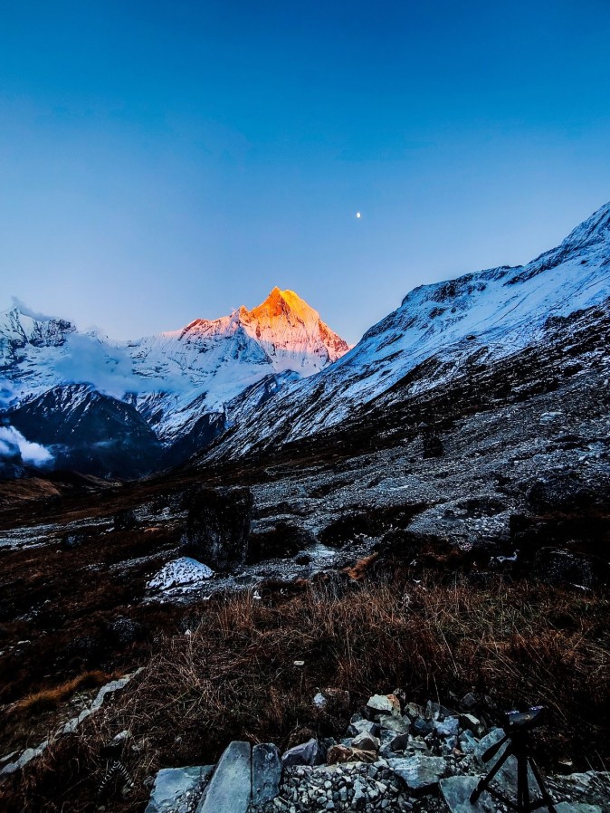
What sets the Mustang trek apart from other Himalayan routes is not dramatic snow peaks (though Nilgiri, Dhaulagiri, and Tukuche Peak remain visible for much of the journey). It is the terrain itself. Trekkers walk through canyons and across plateaus rather than up forested switchbacks, passing chortens, mani walls, and cave complexes carved into cliffs centuries ago. Until 1992 the northern part of the district — historically the Kingdom of Lo — was closed to outsiders. That isolation helped preserve its language, architecture, and culture.
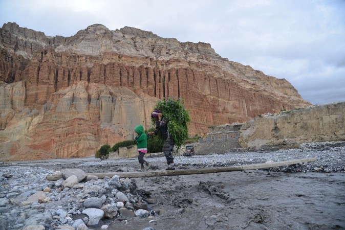
South of Jomsom the Kali Gandaki flows through one of the deepest river gorges on Earth, flanked by the Annapurna and Dhaulagiri ranges. North of Kagbeni the landscape changes again: green disappears and the trail climbs onto a high desert plateau of ochre cliffs, wind-eroded pinnacles, and dry riverbeds.
Late afternoon is when Mustang earns its name. As the sun drops toward the western ridgeline, the sedimentary cliffs above villages such as Chele, Ghami, and Dhakmar shift from pale tan to deep gold to dusty red before the cold arrives quickly, as it always does at altitude once the sun is gone. Caves — some natural, some hand-carved as dwellings, meditation retreats, or burial sites — pockmark the cliff faces above nearly every settlement.
| Feature | Lower Mustang | Upper Mustang |
|---|---|---|
| Area | Jomsom, Kagbeni, Marpha south to Tatopani | Kagbeni north to Lo Manthang & Tibetan border |
| Access | Open (Annapurna Conservation Area) | Restricted Area Permit (RAP) required |
| Guide | Recommended | Mandatory (licensed guide) |
| Culture | Thakali, mixed Hindu-Buddhist | Predominantly Tibetan Buddhist |
| Best for | First-time trekkers, short itineraries | Experienced trekkers, longer trips, deeper immersion |
Mustang’s culture is Tibetan in almost every visible way — language, dress, religion, and architecture — the result of centuries of trade and migration across the nearby border.
Key places include:
Trekking in Mustang feels different from Nepal’s forested routes. Trails run along riverbeds, across wind-swept plateaus, and through canyons. Daily elevation gain is often more gradual than on routes such as Everest Base Camp, though days above 3,500–3,800 m still demand proper altitude awareness.
Many itineraries combine walking with short jeep transfers on sections of the Mustang road, especially north of Kagbeni. Teahouse accommodation is available throughout, though rooms in Upper Mustang are simpler and colder. Nights above 3,500 m regularly drop below freezing outside the main seasons, even when days are sunny.
Because Mustang sits in the rain shadow of Annapurna and Dhaulagiri, it is one of the few regions in Nepal that remains trekkable during the summer monsoon.
| Season | Conditions |
|---|---|
| Spring (Mar–May) | Stable weather, clear views, Tiji Festival (usually May) — peak season |
| Summer / Monsoon (Jun–Aug) | Largely dry thanks to the rain-shadow effect — a rare monsoon option |
| Autumn (Sep–Nov) | Classic peak season — clear skies, busier trails nearby |
| Winter (Dec–Feb) | Cold, windy, quiet; Lower Mustang more manageable than Upper |
Most travelers fly or drive from Kathmandu to Pokhara, then continue to Jomsom by short mountain flight or by road via Beni. From Jomsom the trek (or jeep route) heads north through Kagbeni into Upper Mustang, or south through Marpha toward Tatopani for Lower Mustang.
Mountain flights between Pokhara and Jomsom usually depart early morning because valley winds pick up by early afternoon. A licensed trekking agency can confirm current schedules and road conditions, both of which change seasonally.
This classic itinerary balances walking days, acclimatization, and cultural exploration. Exact altitudes, distances, and times vary slightly with route choices and road conditions. Many groups combine trekking with short jeep sections.
Day 1: Arrive Kathmandu (1,400 m)
Day 2: Drive or fly to Pokhara (820 m)
Day 3: Early flight Pokhara → Jomsom (2,720 m), trek or drive to Kagbeni (2,804 m)
Day 4: Kagbeni → Chele / Chhusang (≈3,050 m) — enter Upper Mustang restricted area
Day 5: Chele → Samar / Syangboche (≈3,600–3,800 m) — pass views and first high desert plateau
Day 6: Syangboche → Ghiling / Ghami (≈3,520–3,570 m) — cross Nyi La (≈4,010 m)
Day 7: Ghami → Tsarang / Charang (≈3,560 m) — dramatic red cliffs and long mani walls
Day 8: Tsarang → Lo Manthang (≈3,810–3,840 m) via Lo La
Day 9: Explore Lo Manthang — monasteries (Thubchen, Jampa, Chode), royal palace, optional side trip to Chhoser caves / Nyphu Gompa
Day 10: Optional second exploration day or begin return via Ghar Gompa and Dhakmar
Day 11–12: Return south (Ghami → Samar → Chhusang / Kagbeni) — alternative scenic routes possible
Day 13: Kagbeni / Muktinath → Jomsom
Day 14: Fly Jomsom → Pokhara, then return to Kathmandu
Shorter options: Lower Mustang can be done in 3–5 days. Compressed Upper Mustang itineraries of 7–10 days are possible with more jeep support, though they reduce cultural immersion time.
Altitude range: Roughly 2,700 m (Jomsom) to just over 3,800 m (Lo Manthang), with some passes higher. Gradual ascent and rest days are essential.
Most people come to Nepal for snow peaks and Sherpa villages. Mustang offers something else entirely — a landscape closer to the high plateaus of Tibet than to the rest of the Himalaya, and a culture that stayed sealed off from the outside world well into the 20th century. Walking into Lo Manthang, past a wall that has stood for centuries, into a town of whitewashed palaces and monasteries still in daily use, is a different kind of arrival than reaching a base camp. There is no summit to claim here. There is a kingdom to walk through, quietly, on its own terms.
Q. Where is Mustang in Nepal?
➔ Mustang is a district in north-central Nepal along the upper Kali Gandaki River, between the Annapurna and Dhaulagiri ranges, bordering the Tibetan plateau.
Q. What is the best time to visit Mustang?
➔ Spring (March–May) and autumn (September–November) offer the most stable weather. Because of the rain shadow, the region also remains trekkable through the summer monsoon (June–August).
Q. Is Mustang suitable for first-time trekkers?
➔ Lower Mustang is a good option for first-time trekkers.
Upper Mustang suits those with some prior high-altitude experience.
Q. What is the difference between Upper and Lower Mustang?
➔ Lower Mustang is open access within the Annapurna Conservation Area.
Upper Mustang is a restricted area requiring a special permit and licensed guide, and preserves a more intact Tibetan Buddhist culture.
Q. How difficult is the Mustang trek?
➔ Generally rated easy to moderate. Elevation gain is often more gradual than Everest Base Camp, but altitude above 3,500 m and strong winds still require proper preparation.
Q. Do I need permits for Upper Mustang?
➔ Yes — a Restricted Area Permit (currently USD 50 per person per day), an Annapurna Conservation Area Permit, and a TIMS card, arranged through a registered trekking agency with a licensed guide.
Q. How many days do you need for a Mustang trek?
➔ Lower Mustang: 3–5 days. Full Upper Mustang to Lo Manthang and back: typically 10–14 days depending on route, rest days, and whether you include Kathmandu/Pokhara transfers.
Ready for your Mustang Trek ? Contact Orbit Nepal Adventure today for customized itineraries for easier and adventurous trek.
📲 Contact us directly on WhatsApp: Chat with us on WhatsApp
🌐 Visit: orbitnepaladv.com
📧 Email: orbitnepaladv@gmail.com
💬 Whatshapp: 9779841766021